
Ignacio, Colorado
Ignacio, Colorado
Piinuu | |
|---|---|
 Looking north along Goddard Avenue in Ignacio | |
 Location of Ignacio in La Plata County, Colorado. | |
 Ignacio Location of the Town of Ignacio, Colorado.  Ignacio Ignacio (Colorado) | |
| Coordinates: 37°06′54″N 107°37′59″W / 37.1150°N 107.6331°W[3] | |
| Country | United States |
| State | Colorado |
| County | La Plata County[2] |
| Tribe | Southern Ute Indian Tribe |
| Incorporated (town) | July 7, 1913[4] |
| Government | |
| • Type | Statutory Town[1] |
| Area | |
• Total | 0.43 sq mi (1.12 km2) |
| • Land | 0.43 sq mi (1.12 km2) |
| • Water | 0.00 sq mi (0.00 km2) |
| Elevation | 6,454 ft (1,967 m) |
| Population | |
• Total | 852 |
| • Density | 2,000/sq mi (760/km2) |
| Time zone | UTC−07:00 (MST) |
| • Summer (DST) | UTC−06:00 (MDT) |
| ZIP code[7] | 81137 |
| Area code | 970 |
| GNIS pop ID | 184487 |
| GNIS town ID | 2412787 |
| FIPS code | 08-38535 |
| Website | Town of Ignacio |
The Town of Ignacio (Ute dialect: Piinuu) is a Statutory Town in La Plata County, Colorado, United States. The population was 852 at the 2020 United States Census.[6] Ignacio is the headquarters of the Southern Ute Indian Reservation.
History
[edit]- On February 2, 1848, the Treaty of Guadalupe Hidalgo ceded northern Mexico (including all of the future State of Colorado) to the United States.[8]
- On December 30, 1849, Chiefs of Ute signed the Peace Treaty of Abiquiú with the United States.[9]
- The Territory of Colorado was organized on February 28, 1861.
- The Consolidated Ute Reservation was created on March 2, 1868.[10]
- On September 13, 1873, the Brunot Treaty removed the San Juan Mountains from the Consolidated Ute Reservation.[11]
- La Plata County was created on February 10, 1874.[2]
- The Territory of Colorado became a state on August 1, 1876.
- On November 9, 1878, the Consolidated Ute Reservation was replaced by the much smaller Southern Ute Indian Reservation.[12]
- The Ignacio, Colorado, post office opened on Jan 31, 1882[13]
- The Town of Ignacio was incorporated on July 7, 1913.[1]
Geography
[edit]At the 2020 United States Census, the town had a total area of 0.273 square miles (0.71 km2), all of it land.
Demographics
[edit]| Census | Pop. | Note | %± |
|---|---|---|---|
| 1920 | 290 | — | |
| 1930 | 464 | 60.0% | |
| 1940 | 555 | 19.6% | |
| 1950 | 526 | −5.2% | |
| 1960 | 609 | 15.8% | |
| 1970 | 613 | 0.7% | |
| 1980 | 667 | 8.8% | |
| 1990 | 720 | 7.9% | |
| 2000 | 669 | −7.1% | |
| 2010 | 697 | 4.2% | |
| 2020 | 852 | 22.2% | |
| U.S. Decennial Census[14] | |||
See also
[edit]- Bibliography of Colorado
- Geography of Colorado
- History of Colorado
- Index of Colorado-related articles
- List of Colorado-related lists
- Outline of Colorado
- Ute people
References
[edit]- ^ a b c "Active Colorado Municipalities". Colorado Department of Local Affairs. Retrieved February 1, 2025.
- ^ a b "Colorado Counties". Colorado Department of Local Affairs. Retrieved February 1, 2025.
- ^ a b "Ignacio, Colorado". Geographic Names Information System. United States Geological Survey, United States Department of the Interior. Retrieved February 1, 2025.
- ^ "Colorado Municipal Incorporations". State of Colorado, Department of Personnel & Administration, Colorado State Archives. December 1, 2004. Retrieved September 2, 2007.
- ^ "2019 U.S. Gazetteer Files". United States Census Bureau. Retrieved July 1, 2020.
- ^ a b United States Census Bureau. "Ignacio town; Colorado". Retrieved April 22, 2023.
- ^ "ZIP Code Lookup". United States Postal Service. Retrieved February 1, 2025.
- ^ 9 Stat. 922
- ^ The United States of America and the Capote and Mouache Utes (December 30, 1849). "Treaty with the Utah". Retrieved March 16, 2022.
- ^ The United States of America and the Ute Nation (March 2, 1868). "Treaty between the United States of America and the Tabeguache, Muache, Capote, Weeminuche, Tampa, Grand River, and Uintah Bands of Ute Indians" (PDF). Fortieth United States Congress. p. 619. Retrieved March 16, 2022.
- ^ Forty-third United States Congress (April 29, 1874). "An act to ratify an agreement with certain Ute Indians in Colorado, and to make an appropriation for carrying out the same" (PDF). p. 36. Retrieved March 16, 2022.
{{cite web}}: CS1 maint: numeric names: authors list (link) - ^ United States of America and the Capote, Mouache, and Weeminuche Utes (November 9, 1878). "Agreement with the Capote, Muache, and Weeminuche Utes" (PDF). Pagosa Springs, Colorado. Retrieved March 16, 2022.
{{cite web}}: CS1 maint: multiple names: authors list (link) - ^ Bauer, William H.; Ozment, James L.; Willard, John H. (1990). Colorado Post Offices 1859–1989. Golden, Colorado: Colorado Railroad Historical Foundation. ISBN 0-918654-42-4.
- ^ "Census of Population and Housing". Census.gov. Retrieved June 4, 2015.
External links
[edit]Wikimedia Commons has media related to Ignacio, Colorado.
Municipalities and communities of La Plata County, Colorado, United States | ||
|---|---|---|
| City | 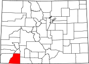 | |
| Towns | ||
| CDPs | ||
| Unincorporated communities | ||
| Ghost towns | ||
| Indian reservations | ||
| Footnotes | ‡This populated place also has portions in an adjacent county or counties | |
| International | |
|---|---|
| National | |